- Thank you received: 0
Mro--First Looks
- RobRatliff
-
- Offline
- New Member
-

Less
More
18 years 4 months ago #19291
by RobRatliff
Replied by RobRatliff on topic Reply from Robert Ratliff
wow i right clicked on the last pic sent it to my pictures and then right clicked on preview,and low and behold on the mountain in the middle of the pic is what looks like a soldier with a helmet looking straight at you and beside him probably his queen is a side view of her.what an amazing pic.great post.i tried to use a different viewer but not with as good results.use preview it worked best for me
Please Log in or Create an account to join the conversation.
- neilderosa
-
- Offline
- Platinum Member
-

Less
More
- Thank you received: 0
18 years 4 months ago #18582
by neilderosa
Replied by neilderosa on topic Reply from Neil DeRosa
<blockquote id="quote"><font size="2" face="Verdana, Arial, Helvetica" id="quote">quote:<hr height="1" noshade id="quote"> wow i right clicked on the last pic sent it to my pictures and then right clicked on preview,and low and behold on the mountain in the middle of the pic is what looks like a soldier with a helmet looking straight at you and beside him probably his queen is a side view of her.what an amazing pic.great post.i tried to use a different viewer but not with as good results.use preview it worked best for me [RobRatliff]<hr height="1" noshade id="quote"></blockquote id="quote"></font id="quote">
Rob
The pics posted here are compressed versions of the originals; the one you copied was only around 37 kbytes. You can download the Browser version (1.5 mbytes) rapidly (at the link) and it contains much more information and hence more detail. The full scale JP 2 image contains 266 mbytes, and of course only that image allows you to see the full scale detail intended by the MRO HiRISE camera.
hiroc.lpl.arizona.edu/images/PSP/PSP_001390_1735/
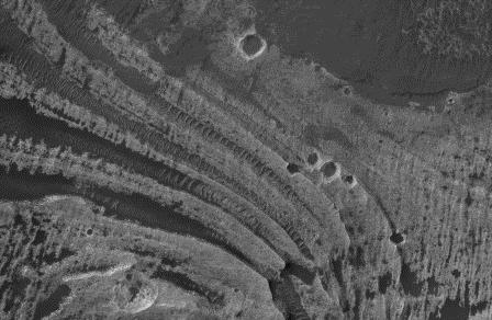
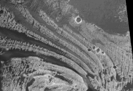
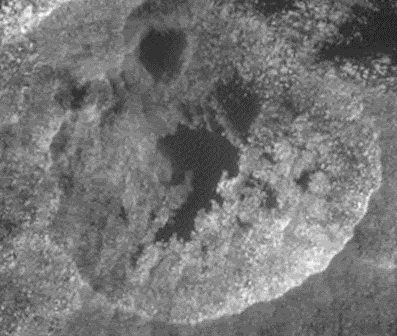
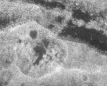
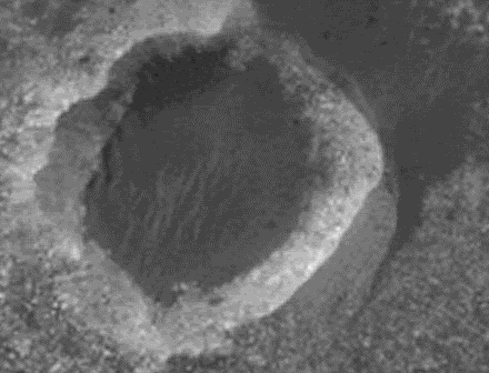
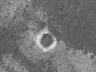
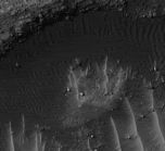
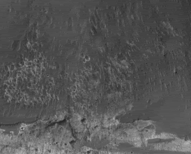
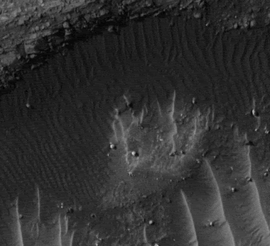
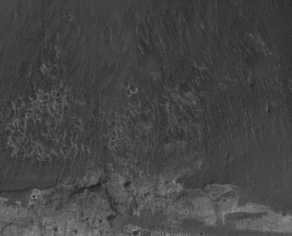
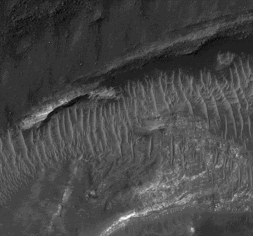
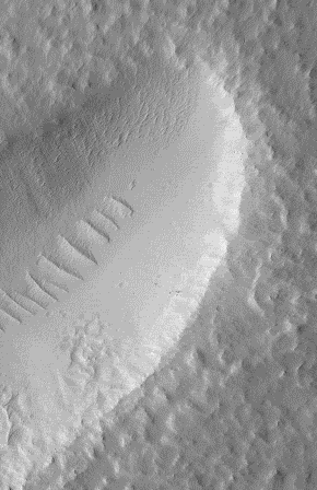
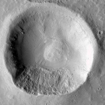
For example, here are some crops from the full scale version. Next to them are the same land formations as seen in R09 but at lower resolution. (Remember these are compressed versions so they can't really be enlarged or zoomed in, to do that you have to go back to the originals at the link.)
PSP context
R09 context
PSP crater 1
R09 crater 1
PSP crater 2
R09 crater 2
PSP landform
R09 same landform
Anyone not familiar with the terms "compressed or reduced" versions, try zooming in on and cropping these craters and landforms from the 37 kbyte compressed image above.
[ ]
]
Rob
The pics posted here are compressed versions of the originals; the one you copied was only around 37 kbytes. You can download the Browser version (1.5 mbytes) rapidly (at the link) and it contains much more information and hence more detail. The full scale JP 2 image contains 266 mbytes, and of course only that image allows you to see the full scale detail intended by the MRO HiRISE camera.
hiroc.lpl.arizona.edu/images/PSP/PSP_001390_1735/
For example, here are some crops from the full scale version. Next to them are the same land formations as seen in R09 but at lower resolution. (Remember these are compressed versions so they can't really be enlarged or zoomed in, to do that you have to go back to the originals at the link.)
PSP context
R09 context
PSP crater 1
R09 crater 1
PSP crater 2
R09 crater 2
PSP landform
R09 same landform
Anyone not familiar with the terms "compressed or reduced" versions, try zooming in on and cropping these craters and landforms from the 37 kbyte compressed image above.
[
Please Log in or Create an account to join the conversation.
- neilderosa
-
- Offline
- Platinum Member
-

Less
More
- Thank you received: 0
18 years 4 months ago #18590
by neilderosa
Replied by neilderosa on topic Reply from Neil DeRosa
As I said, the faces found in the the East Candor Chasma Image posted by me last are not very compelling, but I believe that a search for artificial structures on Mars ought to be kept public, so I'm doing what I can, time permitting.
This first face or mask is similar to others found in the MOC images. It is around 70 meters wide. PSP001390-1735 Face 1.
At around 2 km wide, this large face is also low in detail. PSP001390-1735 Face 2.
Same faces enlarged.
Context for face 1.
This first face or mask is similar to others found in the MOC images. It is around 70 meters wide. PSP001390-1735 Face 1.
At around 2 km wide, this large face is also low in detail. PSP001390-1735 Face 2.
Same faces enlarged.
Context for face 1.
Please Log in or Create an account to join the conversation.
- neilderosa
-
- Offline
- Platinum Member
-

Less
More
- Thank you received: 0
18 years 4 months ago #18622
by neilderosa
Replied by neilderosa on topic Reply from Neil DeRosa
I want to point out a couple of amazing phenomena; one physical and the other sociological.
First the physical one.
Awhile back Trinket posted this image as a possible artifact. Not his words but that was the implication.
TRA000878-1410 Terra Sirenium symbol.
My sense if that because of lack of detail and other possible explanations (e.g. errosion, in this gullied crater) the evidence is weak. But that's not the reason I'm re-posting it.
The next crop of the same object shows a straight line, but as this crop and the next clearly indicate, the line is in the image and not in the object. That is to say, due to the varying resolution of the adjoining image segments of the HiRISE image, there is the appearance of a straight line between them. But clear thinking inspires us to realize that this is not something actually on Mars in the terrain. Obvious? I’m beginning to wonder.
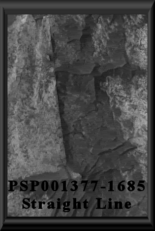
Now here is a real straight line I’ve posted before, that by all indications actually is in the terrain on Mars. This in my opinion amounts to a smoking gun since there is no known geological process that can produce such a form. (This line is a few hundred meters long, and on an old geological surface).
Here is the sociological point. Tom mentioned a few times that he was afraid that this forum was being monopolized by artificiality advocates with little or no opposition. That may have been true at some time in the past, but it has not been true since I’ve been involved in this project. The opposite is true—overwhelmingly.
I’m reminded of a little scene from a Tim Allen movie. Jim Belusci is trying to teach Tim enough karate to enable him to defend himself in an upcoming epic (for him) battle. But Tim is overwhelmed by the demanding and uncompromising courage and hard work necessary, so he goes over to the punching bag and starts poking around it, ineffectually punching the bag instead of working on the real problem.
Neil
Please Log in or Create an account to join the conversation.
- neilderosa
-
- Offline
- Platinum Member
-

Less
More
- Thank you received: 0
18 years 4 months ago #19121
by neilderosa
Replied by neilderosa on topic Reply from Neil DeRosa
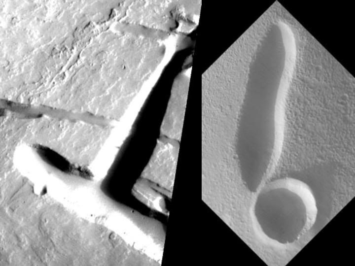
Here is slide 18 from Tom’s Slide Show (see link below) with caption quoted:
'T'&'!': Natural channels rarely end in a perpendicular 'T'-shape for
obvious reasons. In the image on the right, the crater appears to have
extremely steep walls and a flat floor. The elongated shape is incompatible
with crater formation mechanisms because of their explosive, rather than
excavating, nature. No "source' or "sink' is available for excavation to
have occurred by flowing liquid. Source for "T': SP243004.jpg. [TVF]
www.metaresearch.org/solar%20system/cydo...act_html/default.htm
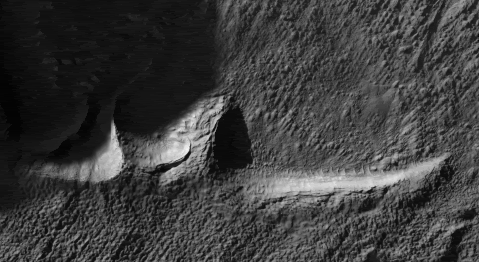
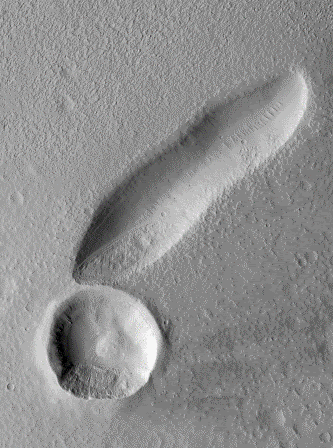
We now have a HiRISE confirmation of the “!”. Here are some basic measurements.
“The complete image is centered at 35.9° (N) latitude, 274.9° East (85.1°W) longitude”
Location: East Mareotis Tholus
Complete image = 13851 pixels wide x .5 m/p = 6925.5 meters wide
Trench = 2359 meters long
Crater = 866 meters diameter.
hiroc.lpl.arizona.edu/images/PSP/PSP_001364_2160/
We are lucky to have any opportunity to verify or falsify any previous predictions for artificiality.
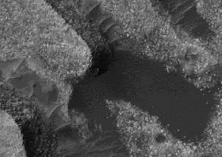
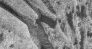
crop 1
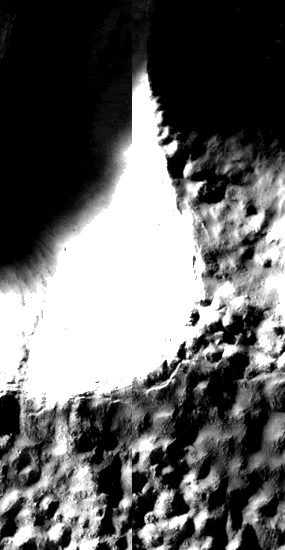
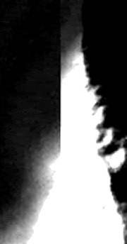
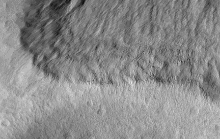
And some HiRISE close-ups.
crop 2
crop 3
crop 4
Remember, these are compressed images for posting on web pages. The original (around 100 mbytes) is available at link.
Neil
Please Log in or Create an account to join the conversation.
18 years 4 months ago #19392
by jrich
Replied by jrich on topic Reply from
<blockquote id="quote"><font size="2" face="Verdana, Arial, Helvetica" id="quote">quote:<hr height="1" noshade id="quote"><i>Originally posted by neilderosa</i>
<br />Here is slide 18 from Tom’s Slide Show (see link below) with caption quoted:
'T'&'!': Natural channels rarely end in a perpendicular 'T'-shape for
obvious reasons. In the image on the right, the crater appears to have
extremely steep walls and a flat floor. The elongated shape is incompatible
with crater formation mechanisms because of their explosive, rather than
excavating, nature. No "source' or "sink' is available for excavation to
have occurred by flowing liquid. Source for "T': SP243004.jpg. [TVF]
We now have a HiRISE confirmation of the “!”. Here are some basic measurements.
“The complete image is centered at 35.9° (N) latitude, 274.9° East (85.1°W) longitude”
Location: East Mareotis Tholus
Complete image = 13851 pixels wide x .5 m/p = 6925.5 meters wide
Trench = 2359 meters long
Crater = 866 meters diameter.
We are lucky to have any opportunity to verify or falsify any previous predictions for artificiality.<hr height="1" noshade id="quote"></blockquote id="quote"></font id="quote">My favorite explanation for these depressions is that they are lava tubes or other tunnel features (can't rule out artificial tunnels, I suppose) that have collapsed. This seems a good explanation for the "!" feature. The seismic shock of the meteor impact caused the roof of a nearby cavity to collapse. Alternatively, the crater and the trench could be completely unrelated - their formation temporally separate and their close proximity totally coincidental (not too unlikely considering the amount of cratering on Mars).
JR
Please Log in or Create an account to join the conversation.
Time to create page: 0.270 seconds

